The construction industry is experiencing a technological revolution, and construction site monitoring with satellite technology stands at the forefront of this transformation. As projects become more complex and stakeholder expectations rise, traditional monitoring methods are proving insufficient for today’s demanding construction environment. Satellite-based monitoring represents a quantum leap from reactive troubleshooting to proactive risk management, offering unprecedented insights into ground stability, structural integrity, and environmental compliance.
This revolutionary approach leverages cutting-edge technologies like DInSAR (Differential Interferometric Synthetic Aperture Radar), high-resolution optical imagery, and AI-enhanced analytics to detect millimeter-level ground movements before they become catastrophic failures. From luxury developments along Mexico’s Pacific coast to critical infrastructure projects in urban centers worldwide, construction site monitoring with satellite is rapidly becoming an indispensable tool for modern construction management.
What is Construction Site Monitoring with Satellite?
Construction site monitoring with satellite represents a paradigm shift in how we approach project oversight and risk management. This technology utilizes space-based radar and optical sensors to continuously observe construction sites, detecting ground deformation, structural movement, and environmental changes with unprecedented accuracy and coverage.
How Satellite Monitoring Works on Construction Sites
The process begins with satellites equipped with Synthetic Aperture Radar (SAR) sensors that emit microwave signals toward Earth’s surface. These signals bounce back to the satellite, carrying information about ground elevation and movement. By comparing data from multiple passes over the same area, sophisticated algorithms can detect changes as small as 1-2 millimeters.
Types of Satellite Data for Construction Projects
Satellite Types and Capabilities
| Satellite Type | Resolution | Coverage Area | Precision | Best Applications |
|---|---|---|---|---|
| Sentinel-1 (C-band) | 5m x 20m | 250 km swath | ±1-2mm | Large-scale monitoring, regional analysis |
| TerraSAR-X (X-band) | 0.25m x 0.25m | 10 km x 5 km | ±0.5mm | High-precision structural monitoring |
| COSMO-SkyMed (X-band) | 1m x 1m | 40 km x 40 km | ±1mm | Infrastructure monitoring, emergency response |
| ALOS PALSAR (L-band) | 3m x 3m | 70 km swath | ±2-3mm | Vegetation penetration, forestry projects |
| WorldView-3 (Optical) | 0.31m | 13.1 km swath | Visual accuracy | Progress documentation, visual inspection |
Key Technologies: DInSAR, InSAR, and Optical Imagery
DInSAR technology represents the gold standard for ground movement detection in construction site monitoring with satellite applications. By processing multiple radar images taken over time, DInSAR can create detailed deformation maps showing how the ground has moved between acquisitions.
Benefits of Construction Site Monitoring with Satellite
The advantages of implementing construction site monitoring with satellite technology extend far beyond simple data collection, fundamentally transforming how construction projects approach risk management and quality assurance.
Early Risk Detection and Prevention
Traditional monitoring methods often detect problems after significant damage has occurred. Satellite monitoring enables predictive analysis, identifying potential issues weeks or months before they become critical. This early warning capability has proven invaluable for projects ranging from high-rise developments to infrastructure construction.
Cost Savings Through Proactive Monitoring
Studies indicate that proactive monitoring can reduce construction-related incidents by up to 70%, with corresponding cost savings averaging 15-25% of total project budgets. These savings stem from avoiding emergency repairs, minimizing insurance claims, and maintaining project schedules.
Compliance and Safety Improvements
Modern construction projects face increasingly stringent environmental and safety regulations. Construction site monitoring with satellite provides continuous documentation that supports compliance reporting while ensuring worker safety through early hazard detection.
Enhanced Project Management Capabilities
Satellite data integration with project management systems creates unprecedented visibility into construction progress, enabling data-driven decision making and improved stakeholder communication.
Key Applications in Construction Site Monitoring with Satellite
Applications by Industry Sector
| Industry | Primary Applications | Monitoring Focus | Typical Precision | Cost Range (Approx.) |
|---|---|---|---|---|
|
High-Rise Buildings
|
Foundation settlement, structural deformation, excavation stability | Vertical movement, tilt detection, differential settlement | ±1-2mm | $15K-50K/year |
|
Infrastructure
|
Bridge monitoring, road stability, tunnel construction | Long-term settlement, thermal deformation, load-induced stress | ±0.5-1mm | $25K-75K/year |
|
Mining Operations
|
Slope stability, subsidence monitoring, tailings dam surveillance | Ground subsidence, slope movement, environmental impact | ±1-3mm | $20K-60K/year |
|
Coastal Projects
|
Marine construction, port development, coastal erosion | Tidal effects, sediment movement, sea level impact | ±2-4mm | $30K-80K/year |
|
Tunneling
|
Underground excavation, surface settlement, tunnel boring | Surface subsidence, tunnel alignment, ground stability | ±1-2mm | $35K-90K/year |
* Cost ranges are approximate and vary based on project size, monitoring duration, and specific requirements. Contact our specialists for detailed pricing.
Foundation Settlement Monitoring
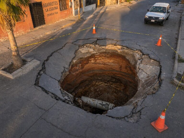
Foundation settlement represents one of the most critical applications for construction site monitoring with satellite technology. Early detection of differential settlement can prevent catastrophic structural failures and enable timely corrective measures.
Excavation Stability Assessment
Large excavations for basements, underground parking, and infrastructure projects create significant risks for surrounding structures. Satellite monitoring provides continuous oversight of both the excavation itself and nearby buildings that might be affected by ground movement.
Infrastructure Deformation Tracking
Bridges, tunnels, and other critical infrastructure require long-term monitoring to ensure structural integrity. The ability to track millimeter-level movements over extended periods makes satellite monitoring ideal for infrastructure asset management.
Environmental Impact Monitoring
Environmental compliance has become increasingly important in construction projects. Satellite monitoring supports environmental impact assessments by tracking changes in vegetation, water bodies, and soil conditions.
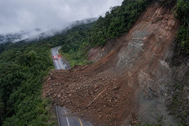
Slope Stability Analysis
Construction in mountainous or unstable terrain requires continuous slope monitoring. Satellite technology can detect subtle changes in slope stability that might indicate impending landslides or rockfall hazards.
Traditional vs Construction Site Monitoring with Satellite Methods
Limitations of Conventional Surveying
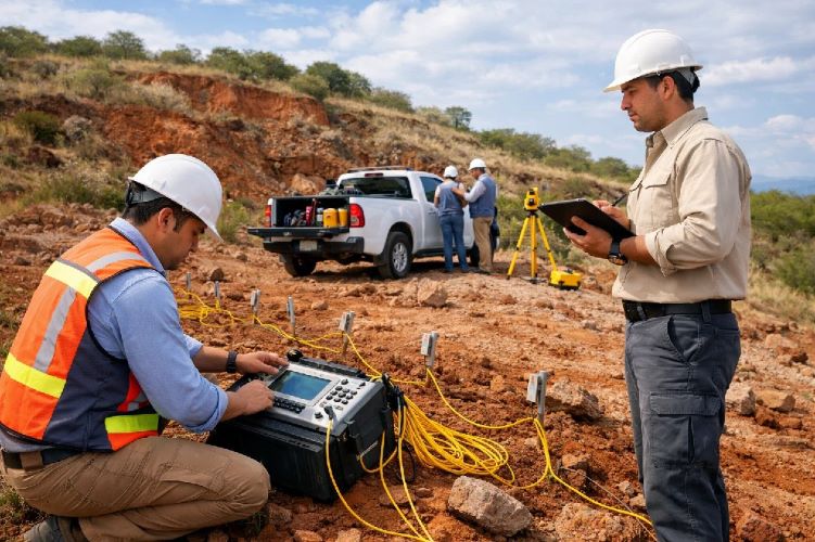
Traditional surveying methods, while proven and reliable, face significant limitations in modern construction environments. Point-based measurements provide limited spatial coverage, requiring extensive interpolation to understand overall site conditions. Weather dependency, accessibility constraints, and safety concerns further limit the effectiveness of conventional approaches.
Advantages of Remote Sensing Technology
Construction site monitoring with satellite technology overcomes these limitations through comprehensive area coverage, weather-independent operation, and enhanced safety. The ability to monitor entire project sites simultaneously provides unprecedented situational awareness.
Cost-Benefit Analysis Comparison
While initial implementation costs for satellite monitoring may appear higher, the total cost of ownership typically favors satellite solutions when considering reduced field work, improved risk management, and enhanced project outcomes.
Integration Possibilities
Modern satellite monitoring systems integrate seamlessly with existing project management platforms, BIM systems, and IoT sensors to create comprehensive monitoring ecosystems.
DInSAR Technology for Construction Site Monitoring with Satellite
How DInSAR Detects Ground Movement
DInSAR technology operates by comparing the phase information from multiple SAR images of the same area taken at different times. When the ground moves, it changes the distance between the satellite and the surface, creating measurable phase differences that can be processed into precise deformation maps.
Millimeter-Precision Measurements
The precision achievable with modern DInSAR systems represents a quantum leap over traditional monitoring methods. X-band satellites like TerraSAR-X can achieve sub-millimeter precision under optimal conditions, while C-band systems like Sentinel-1 provide 1-2mm precision with much larger coverage areas.
Real-Time Alert Systems
Modern construction site monitoring with satellite systems incorporate automated alert mechanisms that notify project managers immediately when predefined movement thresholds are exceeded. These systems can integrate with existing project management platforms and mobile applications.
Data Processing and Analysis
Advanced processing algorithms filter atmospheric effects, correct for orbital variations, and apply sophisticated statistical models to extract meaningful deformation signals from the raw SAR data. Machine learning techniques are increasingly used to identify subtle patterns that might indicate developing instabilities.
Implementation Guide for Construction Site Monitoring with Satellite
Project Assessment and Planning Phase
The initial phase involves comprehensive site evaluation, including geological conditions, project timeline, monitoring objectives, and integration requirements. Our specialists conduct detailed feasibility studies to determine optimal satellite configurations and monitoring parameters.
Technology Selection Criteria
Selecting appropriate satellite systems depends on multiple factors including required precision, monitoring frequency, area coverage, and budget constraints. C-band satellites offer excellent coverage for large-scale monitoring, while X-band systems provide superior precision for critical structural applications.
Integration with Existing Project Management Systems
Modern construction site monitoring with satellite solutions integrate seamlessly with popular project management platforms, BIM software, and IoT sensor networks. APIs enable real-time data sharing and automated reporting workflows.
Staff Training and Capacity Building
Successful implementation requires comprehensive training programs covering data interpretation, alert response protocols, and system maintenance. Our training modules ensure project teams can effectively utilize satellite monitoring capabilities.
ROI Calculation and Budget Planning
Investment in satellite monitoring typically pays for itself through reduced insurance costs, avoided delays, and prevention of costly structural failures. Detailed ROI calculations consider project-specific risk factors and potential cost savings.
Case Studies: Construction Site Monitoring with Satellite Success Stories
Luxury Resort Development in Nayarit
A high-end resort development along Mexico’s Pacific coast faced significant challenges due to coastal erosion and soft soil conditions. Implementation of construction site monitoring with satellite technology enabled early detection of foundation settlement issues, saving the project approximately $2.8 million in potential structural repairs.
The DInSAR monitoring system detected subtle ground movements near the coastal buildings six months before traditional surveys would have identified the problem. This early warning enabled proactive foundation reinforcement, preventing catastrophic failure and maintaining the project schedule.
Urban Infrastructure Projects in Mexico
A major bridge construction project in Mexico City utilized satellite monitoring to track both construction progress and surrounding urban infrastructure. The system successfully identified potential impacts on nearby buildings, enabling protective measures that prevented damage claims and maintained community relations.
International Construction Monitoring Success Stories
Projects worldwide demonstrate the versatility and effectiveness of satellite monitoring technology. From tunnel construction in London to mining operations in Australia, satellite monitoring has become an essential tool for modern construction management.
Future of Construction Site Monitoring with Satellite Technology
AI-Enhanced Detection Systems
Artificial intelligence and machine learning are revolutionizing construction site monitoring with satellite capabilities. Advanced algorithms can now identify subtle patterns in deformation data that human analysts might miss, enabling prediction of failures weeks or months in advance.
Real-Time Processing Capabilities
The next generation of satellite monitoring systems will process data in near real-time, eliminating the traditional delays between data acquisition and analysis. This capability enables immediate response to critical situations.
Integration with IoT and Smart Construction
The future lies in comprehensive monitoring ecosystems that combine satellite data with IoT sensors, smart construction equipment, and building management systems. This integration provides unprecedented visibility into all aspects of construction site conditions.
Autonomous Monitoring Systems
Fully autonomous monitoring platforms are emerging that can self-configure based on project requirements, automatically adjust monitoring parameters, and implement response protocols without human intervention.
Getting Started with Professional Construction Site Monitoring with Satellite Services
Initial Consultation and Site Assessment
Our comprehensive consultation process begins with detailed site analysis, project requirement evaluation, and feasibility assessment. We consider geological conditions, project timeline, monitoring objectives, and budget constraints to develop optimal monitoring strategies.
Custom Monitoring Plan Development
Each project receives a customized monitoring plan designed to address specific risks and requirements. Our plans include satellite selection, monitoring frequency, alert thresholds, and integration specifications tailored to project needs.
Implementation Timeline and Milestones
Professional implementation follows structured timelines with clear milestones, ensuring minimal project disruption and maximum monitoring effectiveness. Regular progress reviews maintain alignment with project schedules.
Ongoing Support and Maintenance
Continuous support includes system maintenance, data interpretation assistance, alert response coordination, and performance optimization. Our commitment extends throughout the project lifecycle and beyond.
Frequently Asked Questions About Construction Site Monitoring with Satellite
How accurate is satellite monitoring compared to traditional surveying?
Modern satellite monitoring achieves precision levels of ±1-2mm for C-band systems and ±0.5mm for X-band systems, often exceeding the accuracy of traditional surveying methods while providing comprehensive area coverage instead of point measurements.
What’s the minimum area size for cost-effective monitoring?
Cost-effectiveness typically begins with projects covering 1-2 hectares, though smaller critical structures may justify satellite monitoring based on risk assessment. Larger projects benefit from economies of scale in monitoring costs.
How often is monitoring data updated?
Update frequency depends on satellite constellation and project requirements. Sentinel-1 provides updates every 6-12 days, while commercial satellites can achieve daily revisits for critical applications.
Can satellite monitoring work in all weather conditions?
Yes, SAR-based monitoring operates through clouds, rain, and darkness, providing consistent data collection regardless of weather conditions. This represents a significant advantage over optical monitoring systems.
What’s the typical cost for construction site monitoring?
Costs vary significantly based on project size, monitoring duration, and precision requirements. Approximate ranges span $15,000-$90,000 annually, with detailed quotes provided based on specific project parameters.
How long does it take to set up monitoring for a new project?
Initial setup typically requires 4-6 weeks for comprehensive implementation, including baseline establishment, system configuration, integration testing, and staff training.
Can monitoring detect underground construction issues?
While satellites primarily detect surface deformation, underground construction activities that cause surface movement are effectively monitored. Ground-penetrating technologies may complement satellite monitoring for comprehensive underground assessment.
Is special software required to view monitoring results?
User-friendly web platforms and mobile applications provide intuitive access to monitoring data without specialized software requirements. Integration with existing project management systems is also available.
How does satellite monitoring integrate with project insurance?
Many insurance providers recognize satellite monitoring as a risk mitigation tool, potentially reducing premiums. Documentation provided by monitoring systems supports insurance claims and demonstrates due diligence.
What happens when the monitoring system detects movement?
Automated alert systems immediately notify designated personnel when predefined thresholds are exceeded. Response protocols are customized for each project, ensuring appropriate action is taken promptly.
Can monitoring help with environmental compliance reporting?
Yes, satellite monitoring provides continuous documentation of site conditions, supporting environmental impact assessments and regulatory compliance requirements throughout project lifecycles.
Is satellite monitoring suitable for temporary construction projects?
Absolutely. The non-invasive nature and rapid deployment capabilities make satellite monitoring ideal for temporary projects where traditional monitoring infrastructure would be impractical.
How far in advance can problems be detected?
Advanced systems can detect developing issues weeks or months before they become critical, enabling proactive intervention and preventing costly failures.
What training is required for construction teams?
Comprehensive training programs ensure effective system utilization. Training covers data interpretation, alert response, and integration with existing workflows, typically requiring 1-2 days for key personnel.
Can monitoring data be shared with multiple stakeholders?
Modern platforms support multi-user access with customizable permissions, enabling contractors, owners, engineers, and other stakeholders to access relevant monitoring information according to project requirements.
Construction site monitoring with satellite technology represents the future of construction management, offering unprecedented capabilities for risk mitigation, cost control, and project success. As the industry continues to embrace digital transformation, satellite monitoring will become increasingly essential for competitive construction operations.
The combination of millimeter-precision measurement, comprehensive coverage, and real-time analysis capabilities makes satellite monitoring an invaluable investment for modern construction projects. With proper implementation and ongoing support, these systems deliver significant returns through enhanced safety, reduced risks, and improved project outcomes.
For construction professionals ready to embrace this transformative technology, expert implementation support ensures successful adoption and maximum benefit realization. The future of construction monitoring is here, and it’s orbiting overhead.