Precision topography is revolutionizing the real estate industry in the coastal region of Puerto Vallarta. With the integration of BIM technology, topographical surveys are providing crucial data for precise site analysis and design development. In this article, we will explore the importance of utilizing precise topography in design projects and the benefits of combining it with BIM technology. From revealing potential site challenges to creating accurate designs, we will dive into how precision topography is optimizing the design process for real estate projects in the beautiful coast of Puerto Vallarta, giving developers a competitive edge.
The Significance of Topography in Project Design
When it comes to real estate and infrastructure development, the role of topography in the design and construction process cannot be overstated. Topographic data forms the foundation for informed decision-making, risk assessment, and efficient project management. The intricate and detailed information provided by topographic surveys is crucial for ensuring that design and construction activities are aligned with the natural features of the land. This level of precision not only minimizes the risks and costs associated with design errors but also contributes to the overall sustainability and resilience of the built environment.
From identifying the optimal location for structural foundations to planning essential infrastructure such as roads and drainage systems, topography plays a fundamental role in every stage of the project lifecycle. The comprehensive understanding of the terrain obtained through topographic surveys enables engineers and designers to create accurate and detailed project plans, taking into account factors such as slope, elevation, and natural drainage patterns. As a result, the seamless integration of topographic information into the design process is essential for the successful realization of construction projects, particularly in dynamic and diverse landscapes such as the coastal areas of Puerto Vallarta.
Acquiring Precise Terrain Data
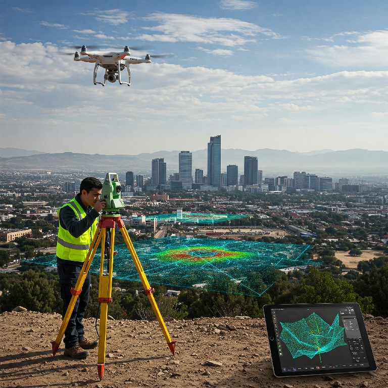
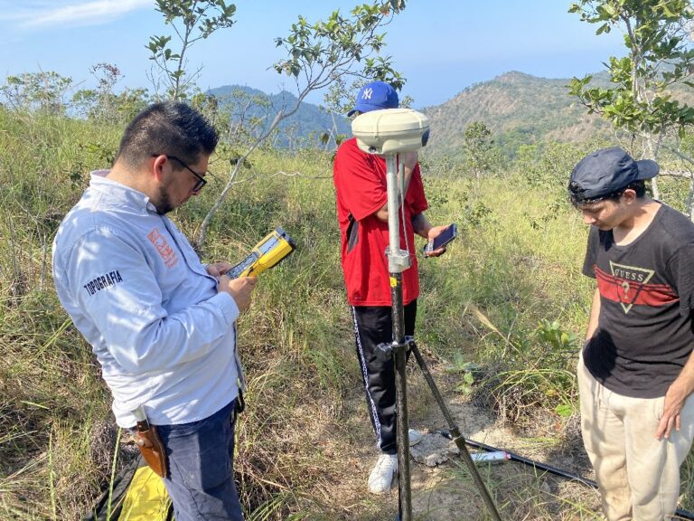
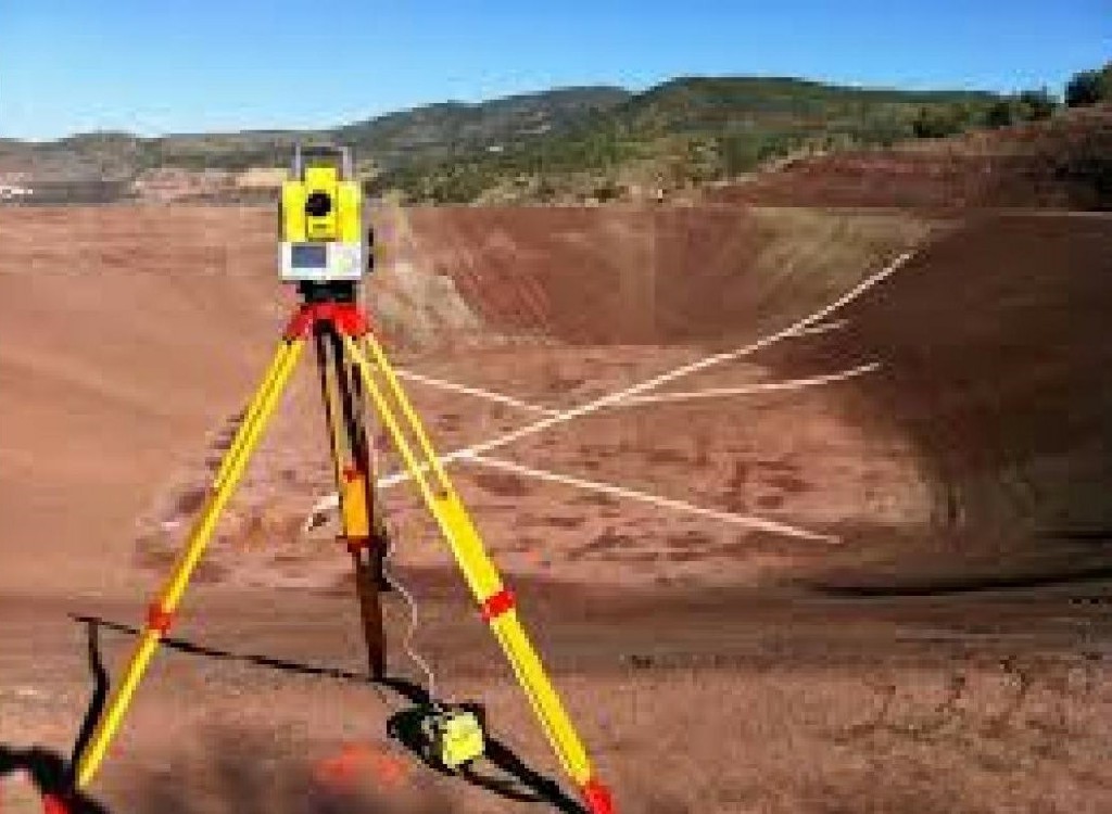
The first and foremost step in leveraging the power of topography for real estate design in the coastal region of Puerto Vallarta is to obtain highly accurate and detailed topographic data of the area. This involves the use of advanced surveying techniques and technologies to capture and record the specific characteristics of the terrain. Whether it’s the undulating topography of a hillside or the intricate features of a waterfront location, the precision of the topographic data directly influences the quality and accuracy of the design and construction processes. Through the employment of cutting-edge tools such as GPS, laser scanning, and 3D aerial mapping, the topographic survey not only captures the existing physical attributes of the land but also provides essential insights for potential future development and environmental impact assessment.
Furthermore, by utilizing state-of-the-art topographic surveying equipment and methodologies, the acquired data is not only detailed and precise but also reliable and comprehensive. The measurement of key terrain elements, the identification of natural and artificial features, and the precise recording of ground surface elevations are conducted with a high level of proficiency and technological sophistication. This approach ensures that the topographic data serves as a dependable foundation for the design and planning of real estate and infrastructure projects, empowering stakeholders to make well-informed decisions and minimize unforeseen challenges during the construction phase.
Detailing the Terrain Relief
In addition to obtaining accurate and intricate topographic data, the next pivotal stage in the optimization of real estate design through topography is the detailed modeling of the terrain relief. Through advanced geographical information systems (GIS) and modeling software, the three-dimensional representation of the land’s surface, its natural features, and the spatial distribution of various elements is meticulously created. This comprehensive and detailed terrain model not only enhances the visualization of the project site but also serves as the basis for a wide range of design and planning activities, from accurate volumetric analysis to the simulation of water flow and drainage patterns.
The detailed terrain relief model, derived from the precise topographic data, allows for the effective visualization and examination of the land from multiple perspectives. This not only aids in the early identification and resolution of design conflicts and spatial constraints but also facilitates the seamless integration of the built environment with the surrounding natural landscape. Moreover, the utilization of Building Information Modeling (BIM) techniques in conjunction with the topography-based terrain models enables real-time collaboration, design coordination, and the generation of constructible project plans, further enhancing the overall efficiency and accuracy of the real estate design and development process.
Revealing Site Challenges and Issues
By employing advanced topographic surveying and modeling techniques, the identification and revelation of potential site challenges and issues are significantly enhanced, providing proactive solutions and risk mitigation strategies. The detailed and precise representation of the terrain not only allows for the early detection of areas prone to erosion, instability, or flooding but also facilitates the development of customized and site-specific design interventions to address these challenges. Furthermore, the integration of geological and geotechnical data within the topographic models enables a comprehensive understanding of subsurface conditions, geological formations, and material characteristics, offering crucial insights for the design and implementation of foundation systems, retaining structures, and slope stabilization measures.
Moreover, the advanced analysis and simulation capabilities facilitated by the integration of BIM with topographic data allow for the assessment of environmental impact, the optimization of sustainable design strategies, and the proactive management of potential site issues. This not only ensures the adherence to rigorous environmental regulations and industry standards but also fosters the development of real estate projects that are resilient, environmentally responsible, and harmoniously integrated with the natural surroundings of Puerto Vallarta’s coastal region.
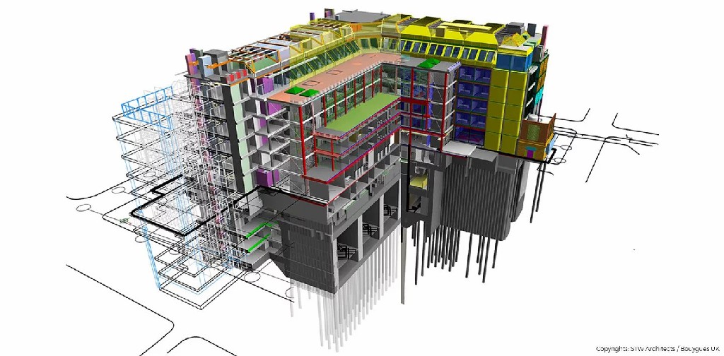
Integrating BIM for Enhanced Efficiency
The integration of Building Information Modeling (BIM) with topographic data in the real estate design and development process represents a paradigm shift towards enhanced efficiency, collaboration, and information management. By harnessing the power of BIM, stakeholders and project teams are able to seamlessly integrate topographic information with architectural, structural, and MEP (mechanical, electrical, and plumbing) models, facilitating a holistic and interdisciplinary approach to design and construction. The centralization of topographic, geospatial, and project data within the BIM environment not only ensures data consistency and accuracy but also streamlines the exchange of information, minimizes errors, and enhances the overall productivity and efficiency of the project lifecycle.
Furthermore, the utilization of BIM for real estate design in the coastal region of Puerto Vallarta enables the dynamic and real-time analysis of topography-based design parameters, such as earthwork volumes, cut and fill optimization, and the integration of sustainable site grading practices. The visualization of design proposals in the context of the existing topography, the generation of accurate quantity takeoffs, and the seamless coordination of design modifications are seamlessly facilitated through the BIM platform, empowering stakeholders to make informed decisions and adapt their designs in response to evolving project requirements. This integrated and information-rich approach not only optimizes the design and planning process but also extends its benefits to the construction and operational phases, laying the foundation for the long-term sustainability and performance of the constructed real estate assets.
Creating Site-Responsive Designs
One of the key advantages of integrating topography and BIM in the design of real estate projects in the coastal region of Puerto Vallarta is the ability to create site-responsive and contextually aware designs that are in harmony with the natural terrain. The detailed and accurate topographic information, combined with the parametric modeling capabilities of BIM, allows for the generation of design solutions that not only respond to the site’s physical characteristics but also embrace the cultural, environmental, and contextual aspects of the region. From the articulation of site-specific architectural forms to the integration of sustainable site infrastructure and landscape design, the collaborative synthesis of topography and BIM empowers design and construction teams to develop projects that are uniquely tailored to their coastal settings, maximizing both aesthetic and functional potential.
Moreover, the generation of comprehensive and detailed site profiles, cross-sections, and visual simulations within the BIM environment provides stakeholders and decision-makers with a profound understanding of how the proposed designs interact with the existing topography. This not only aids in the effective communication of design intent but also facilitates the identification and resolution of potential conflicts and constructability challenges, ensuring that the design solutions are not only visually compelling but also technically feasible and economically viable within the dynamic coastal landscape of Puerto Vallarta.
Establishing Precise Control of Location and Levels
Ensuring the precise control of location and levels is a critical aspect of real estate design and construction, particularly in the dynamic and geographically diverse context of the coastal region of Puerto Vallarta. By integrating the topographic data with the BIM platform, the establishment of accurate and reliable control points, benchmarks, and elevation datums is seamlessly achieved, forming the basis for the precise and coordinated execution of design proposals on the actual site. The dynamic referencing and visualization of topography-based information within the BIM environment not only guide the construction layout and site preparation processes but also facilitate the proactive identification and resolution of potential discrepancies between the designed levels and the existing site conditions, ensuring a seamless and efficient construction workflow.
Furthermore, the real-time monitoring and updating of site-specific location and elevation data within the BIM platform enable construction and engineering teams to maintain a high level of precision and control throughout the entire construction process. This not only minimizes the likelihood of rework and costly errors but also ensures that the constructed real estate projects accurately reflect the design intent and performance criteria, meeting the highest standards of quality and operational excellence in the vibrant and competitive real estate market of Puerto Vallarta’s coastline.
Gaining a Competitive Edge in Puerto Vallarta’s Coastal Real Estate Market

It is evident that the seamless integration of high-precision topographic data and advanced Building Information Modeling (BIM) techniques has the potential to revolutionize the design, construction, and real estate development processes in the dynamic and visually stunning coastal region of Puerto Vallarta. By leveraging the detailed and accurate insights provided by topography and the collaborative and information-rich environment of BIM, real estate stakeholders and project teams are poised to gain a significant competitive advantage. The optimization of design efficiency, the proactive mitigation of site challenges, the creation of contextually responsive designs, and the precise control of site levels and location not only set a new benchmark for quality and innovation but also contribute to the creation of real estate projects that resonate with the unique character and natural beauty of Puerto Vallarta’s coastal landscape, setting a new standard of excellence in the realm of sustainable and high-precision real estate design and development.
From exclusive waterfront developments to environmentally sensitive resort projects, the fusion of topography and BIM transcends the traditional boundaries of design and construction, offering a holistic and transformative approach that not only meets the demands of the present but also embraces the opportunities of the future. The adoption of advanced surveying technologies, the convergence of multidisciplinary expertise, and the visionary utilization of topographic and BIM data not only positions real estate projects for success in the competitive Puerto Vallarta market but also fosters a culture of innovation, sustainability, and enduring value in the vibrant tapestry of the coastal real estate industry.
Conclusion
In conclusion, the integration of BIM in topography projects has revolutionized the construction industry, particularly in the development of real estate projects in Puerto Vallarta’s coastal region. The use of topography ensures precision and accuracy in design, identifying potential challenges and utilizing the terrain’s features to create optimal and efficient designs. With the implementation of topographical surveys and advanced technology, developers can gain a competitive advantage and successfully execute high-precision construction projects.