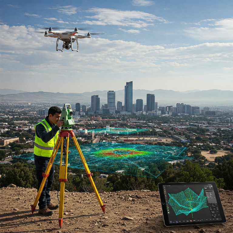
Drone photogrammetry for construction has revolutionized how construction professionals approach site surveying, progress monitoring, and project management. This cutting-edge technology combines unmanned aerial vehicles with advanced imaging techniques to create precise 3D models, accurate measurements, and comprehensive documentation of construction sites. As the construction industry continues to embrace digital transformation, drone photogrammetry offers unprecedented accuracy, efficiency, and cost savings compared to traditional surveying methods.
The integration of construction site mapping through drone technology has become essential for modern construction projects, from residential developments to large-scale infrastructure initiatives. This comprehensive guide explores everything construction professionals need to know about implementing drone photogrammetry solutions in their projects.
What is Drone Photogrammetry in Construction?
Definition and Core Technology
Drone photogrammetry construction refers to the process of using unmanned aerial vehicles equipped with high-resolution cameras to capture overlapping images of construction sites, which are then processed using specialized software to create detailed 3D models, orthomosaic maps, and precise measurements.
The technology relies on the principle of stereoscopic vision, where multiple images taken from different angles are analyzed to determine the three-dimensional coordinates of objects and terrain features. This process enables construction teams to obtain centimeter-level accuracy in measurements and documentation.
📐 Key Technology Components
How Drone Photogrammetry Works in Construction Sites
The drone surveying construction process involves systematic flight patterns over construction sites, capturing hundreds or thousands of high-resolution images with significant overlap. These images are then processed using sophisticated algorithms that identify common points between images and calculate their precise positions in three-dimensional space.
Modern photogrammetry software can process this data to generate various deliverables including digital elevation models (DEMs), orthomosaic maps, point clouds, and 3D mesh models. These outputs provide construction teams with accurate, up-to-date information about site conditions, progress, and potential issues.
Key Components: Hardware, Software, and Expertise
Successful implementation of construction site mapping requires the integration of professional-grade equipment, specialized software, and experienced personnel. The hardware component includes enterprise-level drones capable of precise navigation and high-quality imaging, while software solutions handle the complex processing required to transform raw images into actionable construction data.
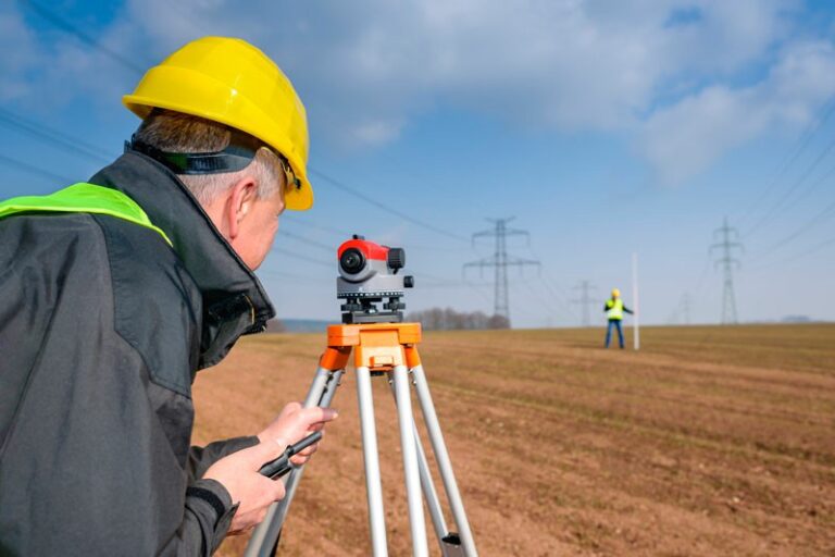
Traditional Construction Surveying vs Drone Photogrammetry
Time Efficiency Comparison
Traditional construction surveying methods typically require days or weeks to complete comprehensive site documentation, especially for large projects. Drone photogrammetry construction can accomplish the same level of detail in hours, allowing for more frequent monitoring and faster decision-making.
⏱️ Time Efficiency Comparison
Traditional Surveying
Complete site documentation
Drone Photogrammetry
Same level of detail
Accuracy and Precision Analysis
While traditional surveying methods can achieve high accuracy at specific points, photogrammetry benefits construction projects by providing comprehensive coverage with consistent precision across the entire site. Modern drone photogrammetry systems can achieve horizontal accuracy of 2-5 centimeters and vertical accuracy of 3-7 centimeters when properly executed with ground control points.
Cost-Benefit Breakdown
The economic advantages of drone photogrammetry construction become apparent when considering the total cost of site documentation over the project lifecycle. While initial technology investment may seem significant, the reduction in labor hours, increased frequency of monitoring, and improved decision-making capabilities result in substantial cost savings.
Safety Advantages on Construction Sites
Construction sites present numerous safety hazards for survey personnel, including unstable terrain, active machinery, and restricted access areas. Drone photogrammetry eliminates the need for personnel to access dangerous areas while providing comprehensive site documentation from a safe distance.
Benefits of Drone Photogrammetry for Construction Projects
Real-Time Progress Monitoring
Construction progress monitoring through drone photogrammetry enables project managers to track advancement against planned schedules with unprecedented detail. Regular aerial surveys provide objective documentation of work completed, helping to identify delays early and adjust resources accordingly.
📊 Progress Tracking
- ✓ Weekly site documentation
- ✓ Comparative analysis
- ✓ Milestone verification
📐 Volume Calculations
- ✓ Cut/fill measurements
- ✓ Material quantification
- ✓ Stockpile monitoring
Volume Calculations and Material Quantification
Accurate material quantification is critical for construction project success. 3D construction modeling through drone photogrammetry provides precise volume calculations for earthwork, material stockpiles, and excavation progress, enabling better resource planning and cost control.
Quality Control and Defect Detection
High-resolution aerial imagery captured through drone photogrammetry allows construction teams to identify potential quality issues, defects, or deviations from design specifications before they become costly problems. This proactive approach to quality management significantly reduces rework and delays.
Stakeholder Communication and Reporting
Visual documentation through drone photogrammetry construction enhances communication with clients, investors, and regulatory agencies. High-quality aerial imagery, 3D models, and progress reports provide clear, objective evidence of project status and quality.
Ready to transform your construction project with drone photogrammetry? Contact GeoSolutions for expert consultation and implementation.
🚀 Start Your Drone Photogrammetry Project Today
Get expert consultation from Puerto Vallarta’s leading photogrammetry specialists
Risk Management and Safety Compliance
Drone surveying construction sites enables proactive risk identification and safety compliance monitoring. Regular aerial surveys can identify potential hazards, monitor safety protocol adherence, and provide documentation for insurance and regulatory purposes.
Types of Construction Projects Using Drone Photogrammetry
Residential Development Projects
Residential construction projects benefit significantly from photogrammetry benefits construction through precise lot surveying, foundation verification, and progress documentation. Developers can monitor multiple properties simultaneously and provide buyers with detailed progress updates.
Commercial and Industrial Construction
Large commercial and industrial projects require comprehensive site documentation due to their complexity and scale. Construction site mapping through drone photogrammetry provides the detailed information necessary for effective project management and coordination between multiple contractors.
Infrastructure Projects (Roads, Bridges, Utilities)
Infrastructure development projects present unique challenges in terms of scale, environmental constraints, and public safety requirements. Drone photogrammetry provides safe, efficient documentation of these complex projects while minimizing disruption to surrounding areas.
Mining and Quarry Operations
Mining operations require regular monitoring of excavation progress, stockpile volumes, and environmental compliance. 3D construction modeling through drone photogrammetry provides accurate measurements essential for operational planning and regulatory reporting.
Coastal and Marine Construction
Coastal construction projects in areas like Puerto Vallarta face unique challenges related to environmental sensitivity and access restrictions. Drone photogrammetry provides comprehensive documentation while minimizing environmental impact and ensuring compliance with coastal protection regulations.
Drone Photogrammetry Workflow for Construction
Pre-Flight Planning and Site Assessment
Successful drone photogrammetry construction projects begin with thorough planning and site assessment. This includes airspace authorization, weather evaluation, site hazard identification, and flight pattern optimization to ensure comprehensive coverage and data quality.
🛸 Photogrammetry Workflow Process
Planning
Site assessment & flight planning
Capture
Aerial data acquisition
Processing
3D model generation
Analysis
Measurements & reporting
Data Acquisition: Flight Patterns and Camera Settings
Optimal data collection requires systematic flight patterns with appropriate overlap percentages, proper camera settings for lighting conditions, and coordination with ground control point placement. Professional drone operators ensure consistent image quality and complete site coverage.
Data Processing and 3D Model Generation
Raw aerial imagery undergoes sophisticated processing using specialized photogrammetry software to generate accurate 3D models, orthomosaic maps, and point clouds. This processing phase requires significant computational resources and expertise to achieve optimal results.
Analysis and Deliverables Creation
Processed data is analyzed to extract meaningful information for construction decision-making. Deliverables typically include volume calculations, progress reports, 3D visualizations, and comparative analyses against previous surveys or design specifications.
Integration with Construction Management Software
Modern construction progress monitoring systems integrate photogrammetry data with existing project management platforms, enabling seamless workflow integration and enhanced decision-making capabilities.
Essential Equipment for Construction Photogrammetry
Professional Drone Recommendations
Enterprise-grade drones suitable for drone photogrammetry construction must balance payload capacity, flight time, precision navigation, and image quality. Popular platforms include DJI Phantom 4 RTK, Wingtra WingtraOne, and senseFly eBee X for different project requirements.
Camera and Sensor Requirements
High-resolution cameras with appropriate lens specifications are essential for quality photogrammetry results. Key considerations include sensor size, resolution, mechanical shutter capabilities, and compatibility with photogrammetry software processing algorithms.
Software Solutions: Processing and Analysis
Professional photogrammetry software such as Pix4D, Agisoft Metashape, and DroneDeploy provide the processing power necessary to transform raw imagery into actionable construction data. Software selection depends on project requirements, processing capabilities, and integration needs.
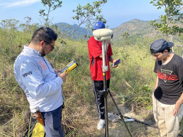
Ground Control Points and Survey Equipment
Accurate georeferencing requires strategically placed ground control points with known coordinates. Professional survey equipment including GPS/GNSS receivers and total stations ensure precise control point establishment and verification.
Case Studies: Successful Implementation
Puerto Vallarta Residential Complex: Progress Monitoring
A major residential development in Puerto Vallarta implemented weekly drone surveying construction to monitor progress across multiple building phases. The project achieved 25% reduction in survey costs while providing unprecedented detail for stakeholder reporting and quality control.
Mexican Mining Project: Volume Calculations
A large-scale mining operation utilized 3D construction modeling for monthly stockpile inventory and excavation progress monitoring. The implementation resulted in 40% time savings compared to traditional surveying methods while improving accuracy of material calculations.
Coastal Resort Development: Environmental Compliance
Environmental sensitive coastal construction required detailed documentation for regulatory compliance. Drone photogrammetry provided comprehensive environmental monitoring while minimizing site disturbance, ensuring project approval and timely completion.
Infrastructure Project: Quality Control Success
A major infrastructure project implemented construction site mapping for quality control and progress verification. Early detection of construction deviations through aerial monitoring prevented costly rework and maintained project schedule adherence.
ROI and Cost Analysis for Construction Companies
Initial Investment Breakdown
The initial investment in drone photogrammetry construction capabilities includes equipment acquisition, software licensing, personnel training, and regulatory compliance. While upfront costs may seem significant, the return on investment typically occurs within 6-12 months for active construction companies.
💰 ROI Analysis
Initial Investment
Equipment, software, training
Monthly Savings
Survey costs, time savings
Payback Period
Typical ROI timeline
Time Savings Quantification
Construction progress monitoring through drone photogrammetry eliminates the time required for traditional site surveying, reducing documentation time from days to hours. This time savings translates directly to cost reduction and improved project efficiency.
Error Reduction and Rework Prevention
Early detection of construction issues through regular aerial monitoring prevents costly rework and delays. Photogrammetry benefits construction projects through improved quality control and proactive problem identification.
Competitive Advantage and Client Satisfaction
Construction companies utilizing drone photogrammetry construction services demonstrate technological leadership and provide enhanced value to clients through improved communication, transparency, and project documentation quality.
Transform your construction projects with professional drone photogrammetry services from GeoSolutions – your trusted partner in México.
Regulatory Compliance and Legal Considerations
Mexican Aviation Regulations (DGAC)
Operating drones for commercial construction site mapping in Mexico requires compliance with Dirección General de Aeronáutica Civil (DGAC) regulations. This includes pilot certification, aircraft registration, and operational authorization for commercial activities.
Construction Industry Standards
Drone photogrammetry construction services must comply with industry standards for accuracy, documentation, and quality control. Professional service providers maintain certification and follow established protocols to ensure reliable results.
Data Privacy and Security Requirements
Construction sites often contain sensitive information requiring appropriate data handling and security measures. Professional drone operators implement secure data collection, transmission, and storage protocols to protect client confidentiality.
Insurance and Liability Considerations
Commercial drone operations require appropriate insurance coverage for equipment, liability, and professional indemnity. Proper insurance protection ensures project continuity and risk mitigation for all stakeholders.
Common Challenges and Solutions
Weather and Environmental Factors
Construction progress monitoring through drone photogrammetry requires favorable weather conditions for optimal results. Professional operators monitor weather patterns and schedule flights during optimal conditions while maintaining flexible scheduling for project continuity.
Site Access and Safety Restrictions
Active construction sites present unique challenges for drone operations including airspace restrictions, safety protocols, and coordination with ongoing activities. Experienced operators work closely with site management to ensure safe, effective data collection.
Data Processing and Storage Requirements
Large-scale 3D construction modeling generates significant data volumes requiring substantial processing power and storage capacity. Professional service providers maintain appropriate infrastructure to handle complex projects efficiently.
Training and Skill Development
Successful implementation of drone surveying construction requires ongoing training and skill development for personnel. Investment in education and certification ensures optimal results and regulatory compliance.
Future Trends in Construction Photogrammetry
AI and Machine Learning Integration
Artificial intelligence and machine learning technologies are enhancing photogrammetry benefits construction through automated analysis, defect detection, and predictive analytics. These advancements promise even greater efficiency and insight for construction applications.
Real-Time Processing Capabilities
Emerging technologies enable real-time processing of photogrammetry data, allowing immediate analysis and decision-making on construction sites. This capability represents a significant advancement in construction site mapping efficiency.
Integration with BIM and Digital Twins
Building Information Modeling (BIM) integration with drone photogrammetry construction creates comprehensive digital twins of construction projects, enabling advanced planning, analysis, and lifecycle management capabilities.
Automated Monitoring Systems
Fully automated drone systems for construction progress monitoring are emerging, capable of autonomous flights, data collection, and basic analysis without human intervention, further reducing costs and increasing monitoring frequency.
How to Choose a Drone Photogrammetry Service Provider
Technical Expertise and Equipment
Selecting the right provider for drone photogrammetry construction services requires evaluation of technical capabilities, equipment quality, and processing expertise. Look for providers with demonstrated experience in construction applications and appropriate certifications.
Local Knowledge and Experience
Local expertise is crucial for successful construction site mapping projects. Providers familiar with local regulations, environmental conditions, and construction practices deliver superior results and smoother project execution.
Certification and Compliance
Ensure your chosen provider maintains appropriate certifications, insurance coverage, and regulatory compliance for commercial drone operations. This protection is essential for project continuity and risk management.
Deliverables and Reporting Capabilities
Evaluate potential providers based on their ability to deliver actionable results in formats compatible with your existing workflows and project management systems. Clear communication and comprehensive reporting are essential for project success.
Drone photogrammetry construction represents a transformative technology for the construction industry, offering unprecedented accuracy, efficiency, and insight for project management. As this technology continues to evolve, construction companies that embrace these capabilities will maintain competitive advantages through improved quality, reduced costs, and enhanced client satisfaction. The investment in drone photogrammetry technology pays dividends through better project outcomes, reduced risks, and increased operational efficiency.
For construction professionals ready to implement these advanced capabilities, partnering with experienced service providers ensures successful adoption and optimal results. The future of construction documentation and monitoring lies in the integration of drone technology with traditional construction practices, creating new opportunities for innovation and excellence in project delivery.
Frequently Asked Questions (FAQ)
General Questions About Drone Photogrammetry
Q: What is the difference between drone photogrammetry and regular aerial photography?
A: While regular aerial photography captures images for visual documentation, drone photogrammetry construction uses specialized techniques to create precise 3D models, accurate measurements, and detailed maps from overlapping images. Photogrammetry requires specific flight patterns, camera settings, and processing software to achieve centimeter-level accuracy for construction applications.
Q: How accurate are drone photogrammetry measurements?
A: Professional drone surveying construction can achieve horizontal accuracy of 2-5 centimeters and vertical accuracy of 3-7 centimeters when properly executed with ground control points. This level of precision is suitable for most construction applications and often exceeds traditional surveying accuracy across large areas.
Q: What weather conditions are required for drone photogrammetry?
A: Optimal conditions include clear skies, minimal wind (less than 25 mph), and good visibility. Light overcast conditions can actually improve image quality by providing even lighting. Construction site mapping cannot be performed during rain, snow, or extremely windy conditions for safety and quality reasons.
🤔 Most Common Questions
How often should we survey?
Weekly for active construction, monthly for long-term monitoring
What’s the minimum site size?
Cost-effective for sites larger than 1 hectare (2.5 acres)
How long does processing take?
1-3 days depending on site size and deliverable complexity
Cost and Implementation Questions
Q: What is the typical cost of drone photogrammetry for construction projects?
A: Costs vary based on site size, frequency, and deliverable requirements. Construction progress monitoring typically ranges from $500-2,000 per survey for small to medium sites, with significant cost reductions for regular monitoring contracts. The investment pays for itself through time savings and improved project management.
Q: Do we need to hire our own drone pilot or can we outsource?
A: Most construction companies find outsourcing drone photogrammetry construction services more cost-effective initially. This eliminates equipment investment, training costs, and regulatory compliance responsibilities while providing access to expert-level capabilities and equipment.
Q: How long does it take to complete a site survey?
A: Flight time typically ranges from 30 minutes to 3 hours depending on site size and required detail. 3D construction modeling processing requires additional time, with basic deliverables available within 24-48 hours and comprehensive analysis within 3-5 business days.
Q: What deliverables can we expect from a photogrammetry survey?
A: Standard deliverables include orthomosaic maps, 3D point clouds, digital elevation models, volume calculations, and progress reports. Custom outputs like cross-sections, contour maps, and integrated BIM models are available based on project requirements.
Technical and Regulatory Questions
Q: Are there restrictions on when and where drones can fly?
A: Yes, construction site mapping operations must comply with local aviation regulations including airspace restrictions, flight time limitations, and weather requirements. Professional operators handle all regulatory compliance and obtain necessary authorizations.
Q: How do ground control points affect accuracy?
A: Ground control points (GCPs) significantly improve drone surveying construction accuracy by providing known reference coordinates. While modern RTK-equipped drones can achieve good accuracy without GCPs, strategic placement of control points ensures optimal precision for critical measurements.
Q: Can photogrammetry work in urban construction environments?
A: Yes, though urban environments present unique challenges including airspace restrictions, safety considerations, and GPS interference. Experienced operators adapt techniques and equipment to successfully capture data in complex urban construction settings.
Q: What happens to our construction data and who owns it?
A: Professional service providers maintain strict data security protocols with clients retaining full ownership of all collected data and deliverables. Data handling agreements specify storage, access, and disposal procedures to protect sensitive project information.
Project-Specific Questions
Q: Can drone photogrammetry detect construction defects?
A: Photogrammetry benefits construction projects through high-resolution documentation that can identify surface irregularities, settlement issues, and deviations from design specifications. While not a replacement for detailed inspections, it provides valuable overview and early warning capabilities.
Q: How does drone photogrammetry integrate with existing project management software?
A: Modern photogrammetry platforms offer integration capabilities with popular construction management software through APIs, file exports, and direct data sharing. This integration enhances construction progress monitoring by combining aerial data with project schedules and reporting systems.
Q: What training do our staff need to understand photogrammetry results?
A: Basic training on interpreting orthomosaic maps, 3D models, and measurement data typically requires 2-4 hours. Most service providers include client training and ongoing support to ensure teams can effectively utilize drone photogrammetry construction data for decision-making.
Q: Can photogrammetry replace traditional surveying entirely?
A: While construction site mapping through drone photogrammetry provides excellent area coverage and monitoring capabilities, traditional surveying remains necessary for precise point measurements, underground utilities, and regulatory boundary establishment. The technologies complement each other effectively.
Getting Started Questions
Q: How do we determine if our project would benefit from drone photogrammetry?
A: Projects larger than 1 hectare, with regular monitoring needs, quality control requirements, or stakeholder reporting demands typically benefit significantly from drone photogrammetry construction services. A site assessment can determine specific applications and ROI potential.
Q: What information do you need to provide a quote?
A: Basic requirements include site location, approximate size, desired frequency of surveys, specific deliverables needed, and project timeline. Site maps or aerial imagery help assess access and complexity factors affecting service delivery.
❓ Still Have Questions?
Get personalized answers from our drone photogrammetry experts
Q: How quickly can we start a photogrammetry program for our project?
A: Construction progress monitoring programs can typically begin within 1-2 weeks of initial contact, depending on site assessment requirements, regulatory approvals, and weather conditions. Emergency or urgent surveys can often be accommodated within 24-48 hours.
The implementation of drone photogrammetry construction technology represents a significant advancement in construction project management, offering unprecedented insight, accuracy, and efficiency. These frequently asked questions address the most common concerns and considerations for construction professionals evaluating photogrammetry services. For specific project requirements or detailed technical questions, consultation with experienced service providers ensures optimal implementation and results.